Emlid currently offers two standout GNSS receivers: the Reach RX and the Reach RS3. Each is designed for specific workflows, so choosing the right one depends on your needs.
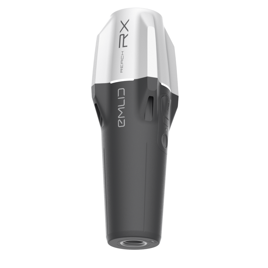
Reach RX – Lightweight, Fast, and Simple
The Reach RX is a compact, plug-and-play RTK GNSS receiver built for speed and simplicity. It delivers centimeter-level accuracy in real time via Bluetooth, making it ideal for:
- Beginners or field workers
- GIS data collection
- Drone ground control point (GCP) placement
- Utility and construction site surveys
- Agricultural field mapping
- Forestry and environmental tracking
Its minimal setup and portability make it perfect for professionals who need reliable positioning without the complexity of traditional GNSS systems.
Industry Examples: How Reach RX Is Used
Some of our customers in the archaeology sector use the Reach RX to accurately mark the locations of artifacts and excavation sites. Additionally, clients in the rail industry are leveraging the Reach RX to provide precise positioning data to PIX4Dcatch for geo-referenced photogrammetry with LiDAR integration
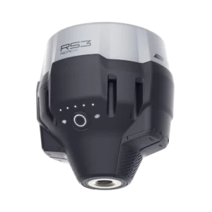
Reach RS3 – Rugged, Versatile, and Feature-Rich
The Reach RS3 is a multi-band RTK GNSS receiver with IMU-based tilt compensation, allowing accurate measurements even when the survey pole isn’t perfectly vertical. It supports both real-time and post-processed workflows and includes advanced features like:
- Built-in LTE modem
- RINEX data logging
- RS-232 and LoRa connectivity
This makes it ideal for:
- Advanced surveyors or drone operators
- Land and construction surveying
- Topographic mapping
- Infrastructure and utility mapping
- Precision agriculture
- Engineering and geospatial data collection
Tilt compensation enables the RS3 to calculate the true position of the pole tip on the ground, even when the pole is not held vertically. This is achieved using an Inertial Measurement Unit (IMU) that tracks the tilt angle and heading in real time
Reach RS3: Trusted Across Industries
The Reach RS3 is widely adopted by professionals in diverse sectors thanks to its precision, reliability, and advanced features.
- Agriculture: Farmers use the RS3 for geofencing fields, recording crop yields, and guiding machinery with high accuracy—streamlining operations and improving productivity.
- Mining: In mining applications, Reach units are deployed to precisely position drill holes, ensuring efficient and safe excavation planning.
- Construction: On construction sites, the RS3 serves as a reliable backup tool. When survey stakes are accidentally displaced by machinery, teams can quickly reposition them without needing to call back the main site surveyor—saving time and reducing downtime.
Emlid GNSS Receiver Comparison Table: Reach RX vs RS3
| Feature | Emlid Reach RX | Emlid Reach RS3 |
| Primary Mode | Network Rover (NTRIP) | Rover and Base Station |
| Tilt Compensation | No | Yes (IMU-based) |
| Connectivity | Bluetooth (for smartphone/tablet connection) Requires an Internet Connection | LTE modem LoRa radio UHF radio Wi-Fi Bluetooth |
| PPK/PPP Support | No | Yes |
| Base Station Capability | No | Yes |
| Weight | 250g | 950g |
| Ingress Protection | IP68 | IP67 |
| Battery Life (Rover Mode) | Up to 16 hours | Up to 18 hours with tilt, 22 hours logging |
Understanding GNSS Accuracy and Corrections
Out of the box, both devices offer meter-level accuracy, similar to standard GNSS receivers. To achieve centimeter-level precision, they require correction data to account for satellite errors and atmospheric conditions.
This is typically done using a GNSS base station, which is placed over a known point. The base calculates signal errors and broadcasts corrections to rover units like the RX or RS3. These corrections can be transmitted locally or via the internet using protocols like NTRIP.
The Reach RS3 can serve as a base station, either locally or remotely. Alternatively, users can subscribe to third-party correction services like RTKFnet, which provide reliable RTK data without needing to set up a base—though internet access is required.
Read more about NTRIP and RTK Corrections: What Is NTRIP? RTK Corrections Explained – Innovelec