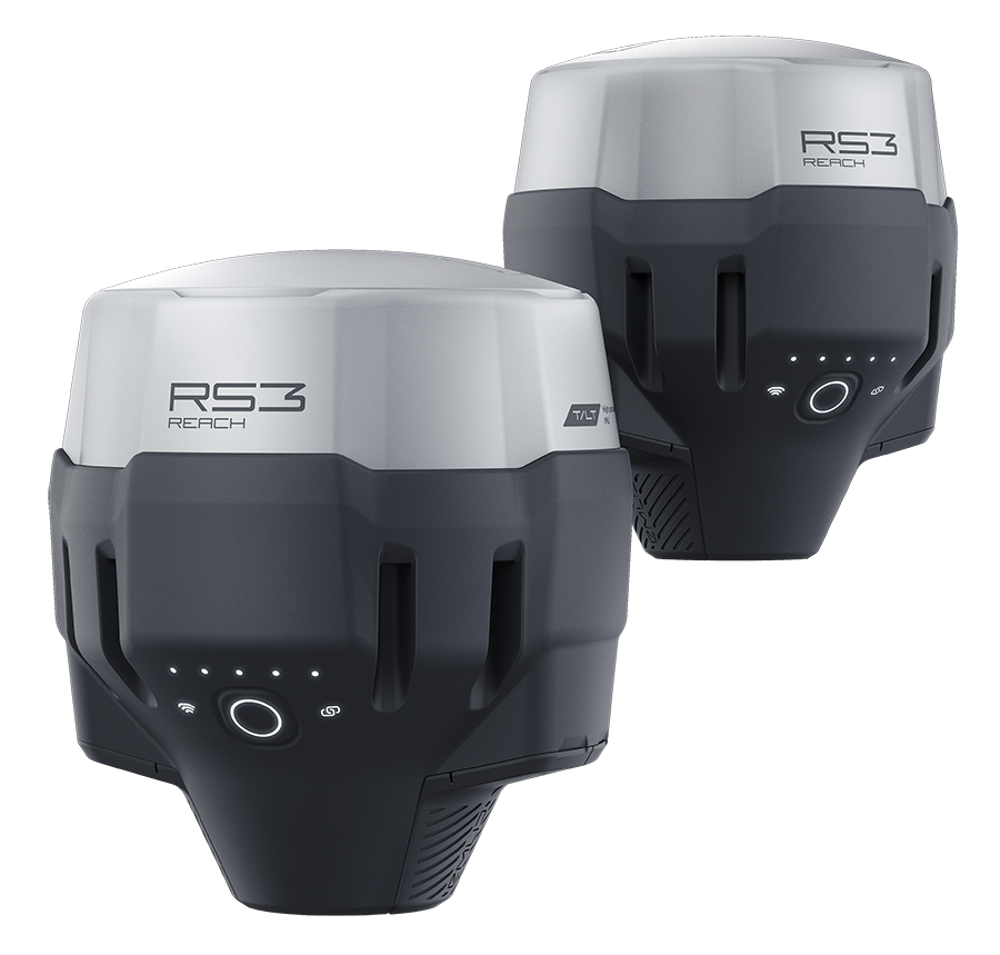
Description
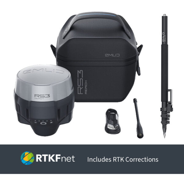
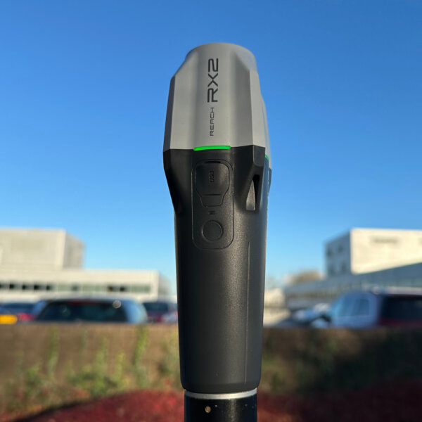
Emlid’s Reach RS3 is an RTK GNSS receiver with IMU tilt compensation and a UHF radio, designed for precise positioning in challenging environments. It supports multi-band GNSS signals, including GPS, GLONASS, BeiDou, and Galileo, and can achieve centimeter-level accuracy within about 5 seconds.
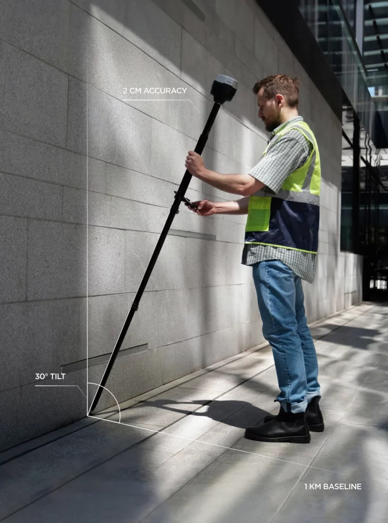
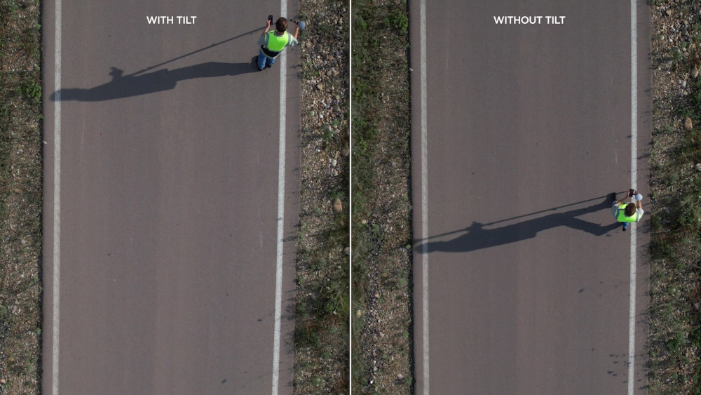
The IMU-based tilt compensation allows for accurate measurements even when the receiver is tilted up to 60 degrees, and it is immune to magnetic interference, making it suitable for use near metal structures or electronic devices.
Emlid’s Reach RS3 is waterproof up to one meter depth and can operate in harsh conditions, with an industrial battery that can last up to 22 hours of logging or 18 hours of working in RTK mode. It can connect up to 10 rovers via the internet or through an NTRIP network, and it supports RINEX logging for post-processing with software like Emlid Studio.
At Innovelec, we are committed to delivering exceptional service to users of Emlid’s Reach RS3. Our support is tailored to meet the unique needs of each customer. Please feel free to contact us to discuss how we can best assist you.
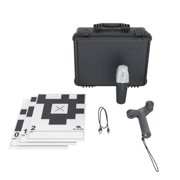
Emlid Reach RS3 Survey Kit offers a range of advantages, including:
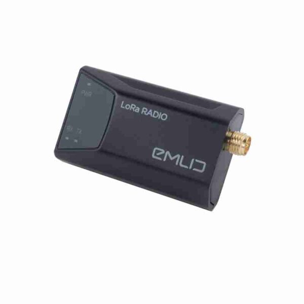
Works with RTK via Local Base Station
You can set up one RS3 unit as a base and the other as a rover.
The base broadcasts correction data directly to the rover using LoRa radio—no need for internet or cellular networks.
This setup gives you centimeter-level accuracy completely offline.
Post-Processed Kinematic (PPK) Support
If real-time corrections aren’t possible, you can log raw GNSS data and process it later using PPK.
This method still delivers high-precision results without needing any live connection.
3. Long Battery Life & Rugged Design
Up to 22 hours of logging and 18 hours with tilt compensation.
Built for fieldwork in remote areas—no need to recharge frequently or rely on external power.
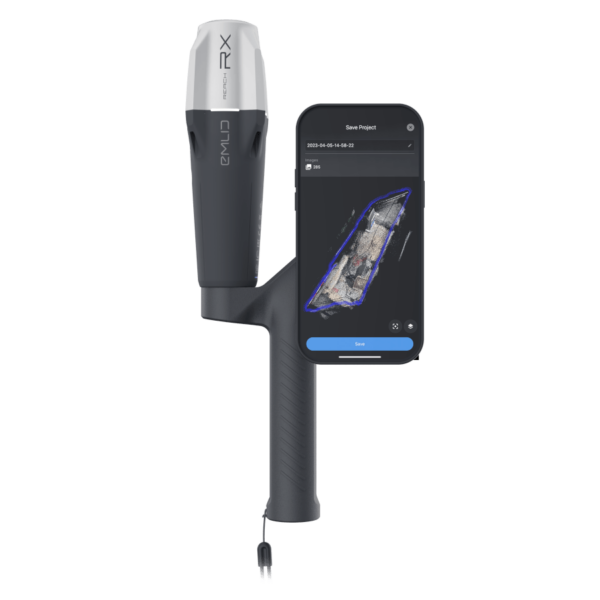
Offline Field App Functionality
The Emlid Flow app works offline for data collection and stakeout.
You can sync your data later when you’re back in coverage or connected to Wi-Fi.
Ideal for Remote Surveying
Perfect for:
Forestry
Mining
Rural construction
Archaeological sites
Environmental monitoring
Emlid Reach RS3 Industries
The RS3, a full-featured, survey-grade GNSS receiver with IMU-based tilt compensation, LoRa and UHF radios, and multi-band RTK/PPK support is ideal for:
Land Surveying
Boundary and topographic surveys
Stakeout in uneven or obstructed terrain (thanks to tilt compensation)
Use with local base stations or CORS networks
Construction
As-built verification
Stakeout and layout in tight or obstructed areas
Integration with BIM workflows
Mining & Aggregates
Grade staking and volumetric measurements
Use in areas with poor cellular coverage via LoRa/UHF
Drone Mapping
Acts as a base station for RTK drones
Collects ground control points (GCPs) with tilt compensation
Public Safety & Forensics
Rapid deployment for crash scene or disaster mapping
Accurate results even with large tilt angles
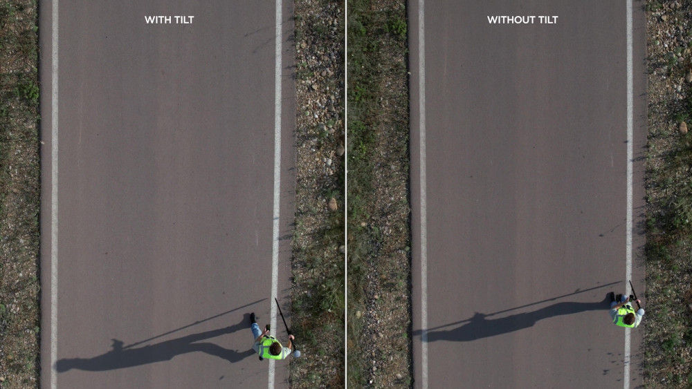
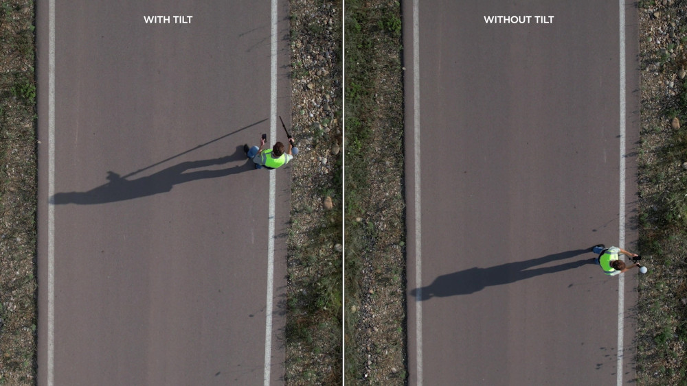
The IMU-based tilt compensation in Reach RS3 enables you to make measurements with up to 60 degrees of tilt while still staying within 20 mm of accuracy.
Reach RS3 continuously measures and corrects tilt in real-time to keep you on target.
Survey and stakeout faster
No need to check the bubble
0 Seconds
8 Seconds
15 Seconds
Effortless and robust
IMU tilt compensation
Calibration-free
We calibrate the inertial measurement unit in each device individually at the factory, so you can get your GNSS unit up and running right out of the box.
Immune to magnetic disturbances
Unaffected by magnetic fields, RS3’s GNSS and IMU sensors provide robust tilt compensation even when working close to metal structures.
Quick initialization
Tilt initialization takes about 20 meters of walking or 10-20 seconds of tilting. Usually ready on the way from the car.
Rapid and Reliable GNSS receiver
Gets a fix in 5 seconds
Reach RS3 gets a centimeter-accurate solution in about 5 seconds. It maintains high-precision and robust performance even when the sky view is partially obstructed, or the receiver itself is tilted.
GPS/QZSS, GLONASS, BeiDou, and Galileo L1C/A, L2C, L1OF, L2OF,B1I, B2I, E1B/C, E5b
RINEX logging and PPP support
Record raw data in the RINEX format for post-processing. You can use our free PPK software, Emlid Studio, or any other software that supports RINEX. Logs are also compatible with OPUS, AUSPOS, and PPP services, so you can get highly accurate results anywhere in the world.
16 GB storage
160+ days of logging at 1 Hz
Up to 22 hours on 1 charge
Reach RS3 comes equipped with a built-in, industrial-grade battery that can endure up to 22 hours of logging or 18 hours of working with tilt in RTK. For uninterrupted multi-day operation, simply connect a power bank, just like you would with your mobile phone.
Charging via USB-C
Built-in LTE modem
Insert a SIM card into your Reach RS3 and let it broadcast or receive corrections via NTRIP.
*To achieve absolute accuracy (i.e., accuracy relative to a global coordinate system), the base station must be placed over a known point and configured with its precise coordinates.
If a known point isn’t available, you can still conduct the survey by averaging the base position over a period of time. While this won’t provide absolute accuracy initially, it allows for relative positioning during the survey.
For full accuracy, you can post-process the survey using RINEX data recorded by the Emlid Reach RS3 base, along with RINEX files from nearby reference stations. This method can refine your results to centimeter-level precision.
In the UK, RINEX data is available from the OS-Net | Ordnance Survey service, typically within a few hours.