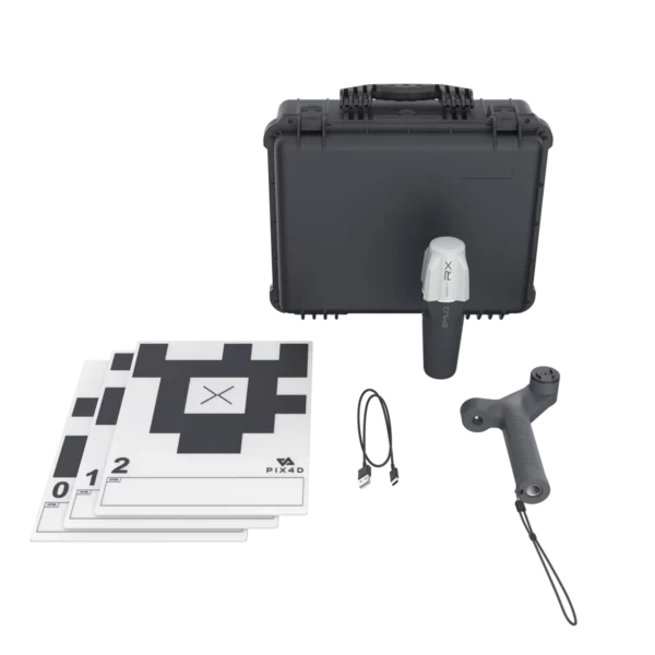
Description
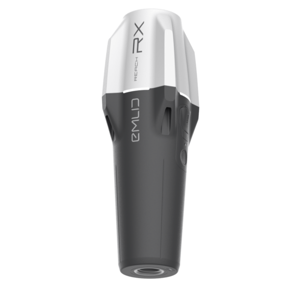
Emlid Reach RS4 PRO
All-band RTK GNSS receiver featuring dual cameras for enhanced visual stakeout and remote point capture—delivering faster, safer, and more efficient fieldwork.
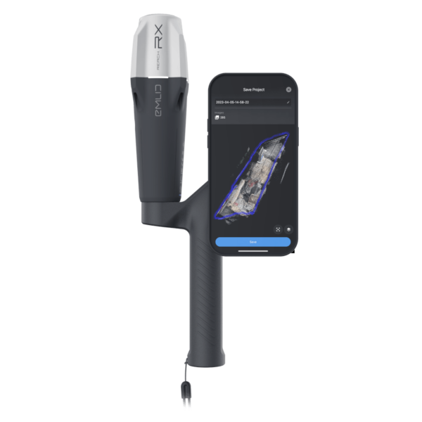
Reach RS4 Pro. Discover the new way to survey with dual cameras
With two Full HD cameras, the RS4 Pro takes surveying and stakeout further than traditional RTK can.
Accelerate stakeout operations with intuitive AR guidance.
With the RS4 Pro, stakeout becomes a visual experience. Instead of relying solely on coordinates, your design is seamlessly overlaid onto the real-world environment—clearly guiding where each stake should be placed.
Dynamic Navigation
Auto bullseye View
Cut & fill Indicator
Quick Point Switch
AR guidance empowers crews to work more efficiently, even on complex construction sites and roadworks, by streamlining tasks and improving accuracy.
Measure What Others Can't Reach — With the Emlid Reach RS4 Pro
Even when you can’t place the pole, you can still capture the point. The RS4 Pro’s dual cameras let you measure building facades, areas behind fences, across busy roads, and other hard-to-reach locations—quickly and safely.
Skip the total station setup and avoid hazardous zones. Save time and stay safe while measuring:
- Across water
- Behind fences
- Over traffic
- Above pits
- Past hedges
- Around machinery

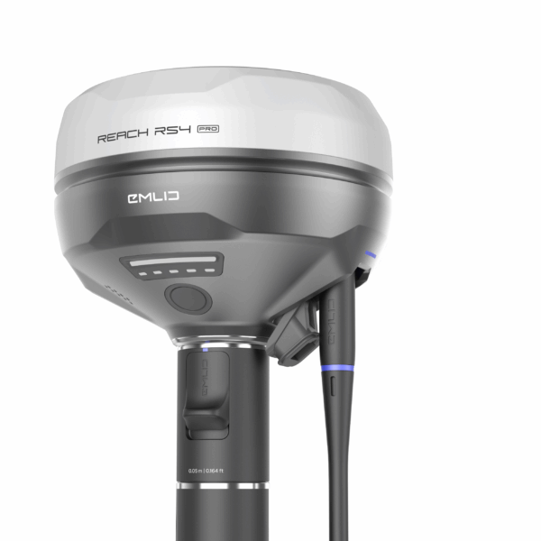
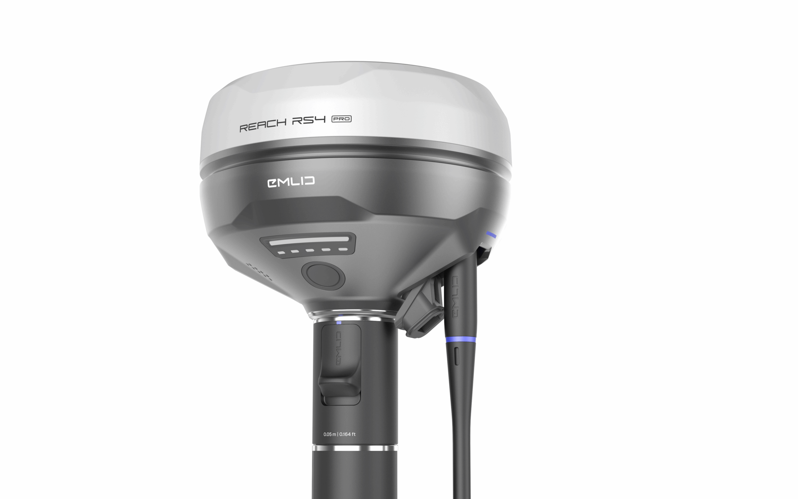
Reach RS4 High-accuracy, even under canopy
The Reach RS4 supports tracking across all major satellite constellations and frequency bands, including the advanced L5 and L6 signals, which offer enhanced resistance to multipath effects and interference. With 672 tracking channels, it can monitor over 40 satellites simultaneously, delivering consistent performance and centimeter-level accuracy.
7mm + 1 ppm in RTK
L1/L2/L5/L6
GPS, GLONASS, Galileo, BeiDou, QZSS, NavIC
672 channels
Fix in less than 5 seconds
Next-gen tilt compensation
The Reach RS4 maintains high accuracy even at steep tilt angles—achieving 18 mm precision at a 30° tilt. Its tilt compensation activates with just a few movements and remains stable throughout the survey, eliminating the need for recalibration and saving valuable time in the field.
Factory-calibrated
Rapid initialization
Interference-proof
Unlimited tilt angles
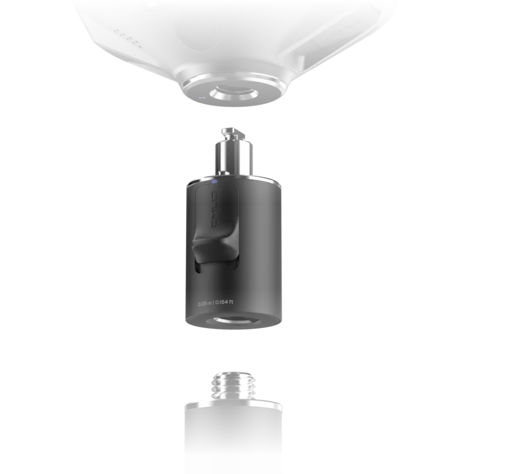
Quick release mount
Engineered specifically for tilt compensation, this mount eliminates backlash and ensures a secure, stable connection between the receiver and the survey pole. Even minimal wobble can affect accuracy during tilted measurements, making a firm attachment essential. The quick-release system enables fast, dependable setup, maximizing precision and efficiency in the field.
Base and rover
NTRIP
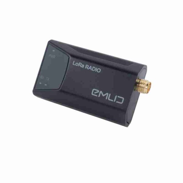
Dual-band radio
UHF 450 MHz
LoRa 915 MHz
The Reach RS4 supports RTK positioning via VRS or single-baseline CORS networks using the RTCM3 format. For added flexibility, it can also connect to another GNSS receiver as an NTRIP base through Emlid NTRIP Caster, enabling seamless integration into various surveying workflows.
Transmit and receive
Up to 2W ( may require a license2 )
Compatible with Reach and 3rd-party receivers with TRIMTALK 450S support3
Designed to excel in extreme environments
The Reach RS4 delivers dependable performance under the toughest conditions
Magnesium alloy body
Crafted from magnesium alloy, the RS4’s body offers exceptional strength while remaining remarkably lightweight. This aerospace-grade material is commonly used in high-performance electronics, striking an ideal balance between durability and portability. Its rugged design ensures reliable operation in demanding environments, while staying easy to carry and handle.
16 hours on one charge
The RS4 delivers up to 16 hours of battery life on a single charge, ensuring uninterrupted operation throughout the day. Recharge via USB-C or connect a power bank for added flexibility in the field. Built to match your pace, it keeps working without pause.
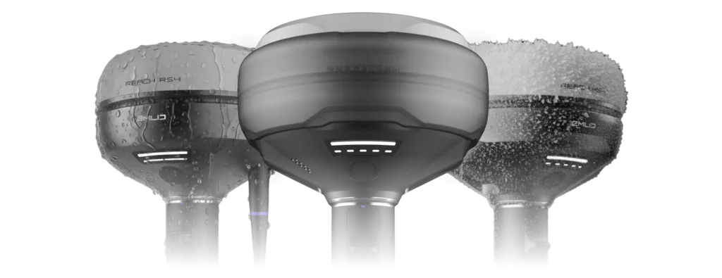
Waterproof
With its IP68 rating, the Reach RS4 is fully dustproof and waterproof, ensuring dependable operation in harsh environments. Whether you’re working in rain, snow, or on a dusty construction site, the RS4 keeps performing without compromise.
-40 to +65 ºС
The Reach RS4 is built to perform in extreme conditions, operating reliably across a wide temperature range from -40°C to +65°C. Whether in freezing cold or intense heat, it consistently delivers excellent performance.
Specification
Mechanical
Dimensions: 128.6 x 128.6 x 99.3 mm
Weight: 920 g
Operating temperatures: -40 to +65 °C
Ingress protection: IP68
Electrical
Autonomy 16 hrs as RTK rover with tilt
Battery Li-Ion 5000 mAh, 7.2 V
36 Wh
Charging: USB Type-C (PD): 5V—3A
9V—3A, 12V—3A, 15V—3A
Positioning
Static H: 4 mm + 0.5 ppm
V: 8 mm + 1 ppm
PPK H: 5 mm + 0.5 ppm
V: 10 mm + 1 ppm
RTK H: 7 mm + 1 ppm
V: 14 mm + 1 ppm
Tilt compensation RTK + 2 mm + 0.3 mm/°
Convergence time ~5 s typically
Connectivity
LoRa radio up to 1W
Frequency range: 868/915 MHz
Power: 0.1 W
Distance: Up to 8 km
UHF radio up to 2W
Frequency range: 410–470 MHz
Protocols: TRIMTALK 450S**
Modulation type: GMSK
ㅤ
LTE modem
Regions: Global
Bands: FDD-LTE: 1, 2, 3, 4, 5,
7, 8, 12, 13,
18, 19, 20, 26, 28
TD-LTE: 38, 39, 40, 41
UMTS (UHPS/FDD):
1, 2, 5, 8
Quad-band, 850/1900
900/1800 MHz
SIM card: Nano-SIM
Wi-Fi: 802.11a/b/g/n
Bluetooth: 5.1 (BR/EDR + LE)
Ports: RS-232, USB Type-C
Data
Corrections NTRIP, RTCM3
Position output NMEA, LLH/XYZ
Data logging RINEX, NMEA, LLH/XYZ, UBX
Internal storage 16 GB
Imaging
Image sensors 1/2.6 in, CMOS,
global shutter, Full HD
Field of view
Front camera H: 64.6°, V: 42.8°
Bottom camera H: 63°, V: 42°
Video frame rate 25 fps
GNSS
Signal tracked
GPS: L1C/A, L2C, L5,
GLONASS: L1OF, L2OF,
Galileo: E1-B/C, E5a, E6,
BeiDou: B1I, B1C, B2a, B3I,
QZSS: L1C/A, L1C/B11, L2C, L5,
NavIC: L1-SPS Data, L5-SPS
Number of channels 672
Update rates up to 10 Hz