Showing 16–30 of 893 results
-
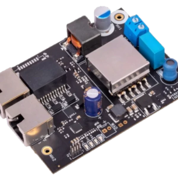
High PoE Board and PoE Splitter / PoE Modules / Power Management / Power over Ethernet / Power over Ethernet
Infomart PEB9300BT Series Power over Ethernet (PoE) IEEE802.3bt 90W All-In-One Board
£66.00 Each INC-VAT (EXW) £66.00The PEB9300BT series of Power over Ethernet (POE) board, offers a complete ready to use all in one board IEEE802.3bt 90W POE solution.
-
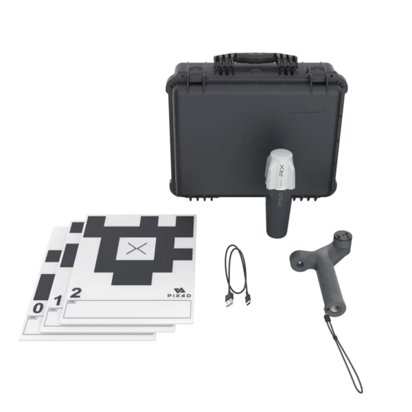
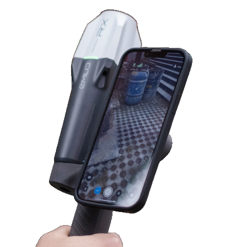
Data Capture Applications / Mapping and 3D modeling / Photogrammetry Software / Survey and Data Collection / Survey and Mapping Kits
High-Precision 3D Scanning Kit – Pix4Dcatch + Emlid Reach RX
Price range: £2,298.00 through £11,473.20 Each INC-VAT (EXW) £2,298.00Pix4D & Emlid Scanning Kit
High Precision 3D Scanning Solution.
Available as Emlid Hardware Only, Emlid Hardware and PIX4D Standard software or Emlid Hardware and PIX4D Advanced Software
-
Emlid Flow Survey Plan – 1 Year
£192.00 Each INC-VAT (EXW) £192.00Emlid Flow – Survey Plan – 1 Year
For advanced surveying
The land survey app for Reach receivers.
-
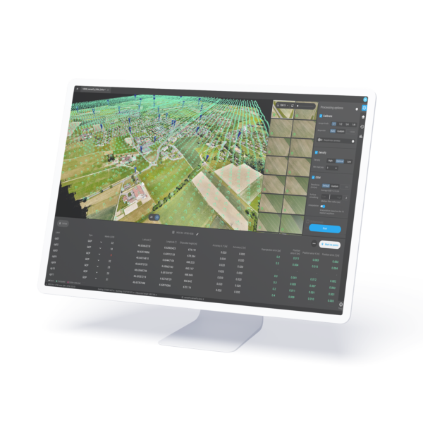
PIX4Dfields – Drone imaging software for Agriculture
Price range: £1,346.40 through £3,249.60 Each INC-VAT (EXW) £1,346.40Next generation photogrammetry software for professional drone and terrestrial mapping
-
PointPerfect – Fleet Plan (35k Hours)
Uniquely flexible usage-based plans are designed to reduce your operating expense
- Works with any GNSS RTK receiver, u-blox or non u-blox, or even a mixed fleet
- Wide uniform coverage over entire continents, countries, and regions
- 3-6 cm accuracy1 and convergence in seconds via both internet and L-band satellite
- Lower bandwidth reduces user mobile data costs
-
PointPerfect – Single Device IP & L-Band Monthly Plan
Uniquely flexible usage-based plans are designed to reduce your operating expense
-
PointPerfect – Single Device IP Monthly Plan
Uniquely flexible usage-based plans are designed to reduce your operating expense
- Works with any GNSS RTK receiver, u-blox or non u-blox, or even a mixed fleet
- Wide uniform coverage over entire continents, countries, and regions
- 3-6 cm accuracy1 and convergence in seconds via both internet and L-band satellite
- Lower bandwidth reduces user mobile data costs
-
Calian TW3972XF GNSS L1/L2/L5 Extended-Filter Antenna Copy
Tallysman TW3972XF GNSS L1/L2/L5 Extended-Filter Antenna.
Employing Tallysman”s Accutenna® technology covering GPS / QZSS – L1 / L2 / L5, GLONASS – G1 / G2 / G3, Galileo – E1 / E5a / E5b, BeiDou – B1 / B2 / B2a, NavIC-L5 as well as SBAS (WAAS / EGNOS / GAGAN / MSAS). In addition to this TW3972XF supports L-Band Corrections.
-
Excess Stock
Arpeggio High-Quality Smart Speaker x1
WS200 High Quality Smart Speaker x1
WAMP 200SB High Resolution, Smart HI-FI Amplifier x1
-
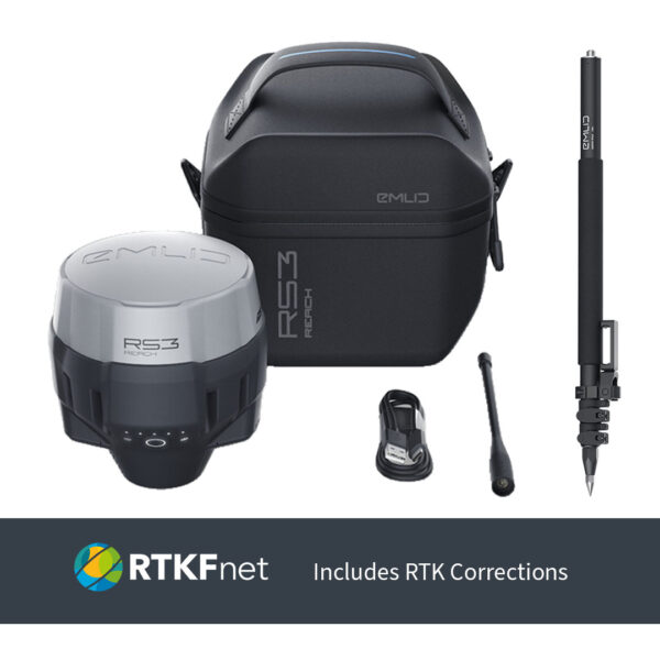
Emlid RCH205 Reach RS3 Professional RTK Survey Kit – Emlid Reach RS3 with NTRIP & Accessories
Price range: £4,077.80 through £4,227.80Complete Professional RTK Survey Kit with the Emlid Reach RS3 – includes GNSS receiver, survey pole, and 1-year NTRIP corrections for fast, accurate results
-
RTKFnet – RTK Corrections Service – 12 Months
Price range: £1,080.00 through £1,230.00 Each INC-VAT (EXW) £1,080.00RTKFnet RTK Corrections Service
12 Months
Optional 12 Months Data SIM Available
-
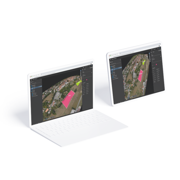
PIX4Dsurvey
Price range: £2,050.80 through £4,459.20 Each INC-VAT (EXW) £2,050.80PIX4Dsurvey is a standalone software developed to bridge the gap between photogrammetry and CAD.
-
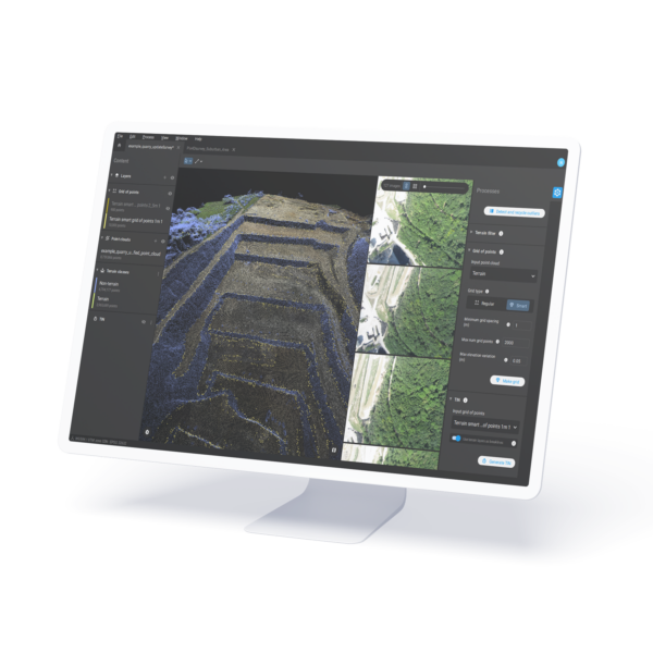
PIX4Dmatic
Price range: £3,336.00 through £6,619.20 Each INC-VAT (EXW) £3,336.00Next generation photogrammetry software for professional drone and terrestrial mapping
-
PIX4Dcloud Cloud-based Photogrammetry Software
Price range: £591.60 through £8,014.80 Each INC-VAT (EXW) £591.60The power of Pix4D on the cloud.
The online platform for drone and ground mapping, site documentation and project collaboration.
-
PIX4Dcatch Precise 3D scans and AR
Price range: £0.00 through £4,003.20 Each INC-VAT (EXW) £0.00Precise 3D scans and AR
Pix4DCatch is a mobile app for creating accurate 3D models and maps.
Pix4DCatch pairs with RTK devices for centimeter-level precision, aiding surveys and documentation.